
Relying on consumer-grade electronics without understanding their specific failure points is the single greatest threat to a solo hiker’s safety.
- Dedicated satellite hardware is non-negotiable; smartphone GPS and batteries are unreliable in environmental extremes.
- Power is a finite budget; solar charging is a high-risk gamble in most real-world conditions.
- Your satellite device’s track log is irrefutable evidence, crucial for both rescue coordination and insurance claims.
Recommendation: Build a redundant safety system where each component is chosen based on its reliability under stress, not its spec sheet. Your lifeline is a system, not a single gadget.
When you are miles from the nearest road, alone, with a broken ankle and a fading headlamp, the brand of your gear is irrelevant. What matters is physics. What matters is whether the device in your hand will function as designed in the cold, wet, and fear-drenched reality of an emergency. Most discussions about outdoor tech revolve around features, weight, and battery life percentages. From a Search and Rescue (SAR) perspective, this is a dangerously incomplete conversation. We see the consequences of gear that works perfectly in a suburban park but fails catastrophically in the backcountry.
The common advice to « carry a backup » or « get a satellite messenger » misses the critical point. A backup is useless if it shares the same fundamental weakness as the primary system. The real key to off-grid safety is not just owning the gear, but deeply understanding its specific failure mechanics. It’s about shifting your mindset from a consumer to a systems operator, one who anticipates points of failure and builds in true, physics-based redundancy. This guide isn’t a product review. It’s a field-debrief from a SAR tech officer on which technologies hold up when things go wrong, and more importantly, why.
We will dissect the critical components of an off-grid safety system, starting with the absolute foundation: reliable power. We will then analyze navigation, personal protection, and the critical decision-making involved in activating your lifeline, before tying it all into the financial safety net of insurance. The goal is to equip you with a framework for making life-or-death gear decisions based on operational reality, not marketing hype.
Summary: Outdoor Adventure Tech: A SAR Operator’s Guide to Off-Grid Safety Systems
- Solar Charger vs Power Bank: Which Is More Reliable in Forest Cover?
- Phone GPS vs Dedicated Handheld: Do You Really Need a Garmin?
- Gore-Tex vs eVent: Which Breathable Membrane Actually Works in High Humidity?
- The « Ultralight » Mistake: Why Trail Runners Fail on Scree Slopes
- When to Trigger Your SOS Beacon: Defining « Life or Death »?
- How to Plan Exploring Adventure Destinations Without Voiding Your Travel Insurance?
- Are Biometric Wearable Devices Accurate Enough for Marathon Training Zones?
- How to Plan Exploring Adventure Destinations Without Voiding Your Travel Insurance?
Solar Charger vs Power Bank: Which Is More Reliable in Forest Cover?
In a SAR scenario, power is your timeline. Every milliamp-hour extends the window for communication and rescue. The popular image of a solar panel strapped to a backpack, heroically gathering energy, is a dangerous fantasy in most environments. The operational reality is that solar charging is a high-risk, low-reward strategy for a solo hiker who needs guaranteed power for a lifeline device. The physics of photovoltaic cells dictates an unforgiving requirement for direct, unobstructed, and high-angle sunlight—three things that are rarely available under dense forest canopy, in a deep canyon, or during the overcast weather that often accompanies emergencies.
Field tests consistently reveal that small, portable solar panels are profoundly inefficient. Under a real-world test, a small solar power bank produced a meager 1.72 watt-hours of energy after an entire day in direct sunlight. Another case study on a 20,000mAh solar power bank found that even with 8 hours of optimal, angled sunlight, it only restored 40-50% of its capacity. A complete recharge from solar alone can take an estimated 18-20 hours of perfect sunlight. This isn’t a backup plan; it’s a gamble. Waiting for the sun to charge a device is time you may not have.
The only reliable solution is a pre-charged, high-capacity power bank. It is a known quantity. A 20,000mAh power bank provides a predictable, environment-agnostic energy budget. It can fully recharge a smartphone 4-5 times or a satellite messenger multiple times over. You are not depending on weather, time of day, or terrain. For a safety system, you must eliminate variables. The power bank is a deterministic energy source; the solar panel is a hopeful accessory. Your lifeline must be powered by the former.
Phone GPS vs Dedicated Handheld: Do You Really Need a Garmin?
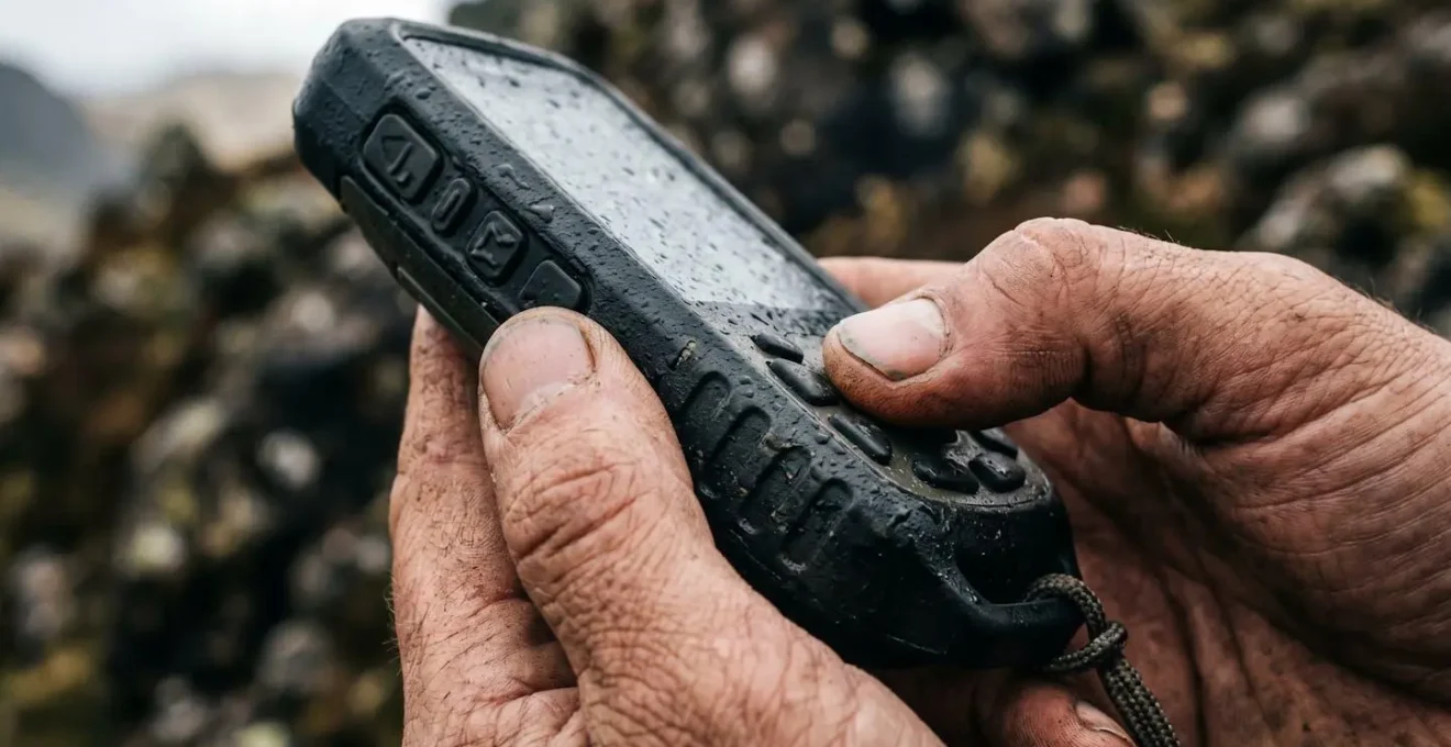
Your smartphone is a marvel of technology, and its GPS is remarkably accurate for day-to-day use. But it is not a lifeline. Relying solely on a phone for off-grid navigation introduces multiple, critical points of failure that a dedicated handheld GPS unit is specifically engineered to overcome. While the gap in pure accuracy is narrowing, with a median horizontal accuracy of smartphone GNSS receivers being just a few meters behind professional devices in open skies, accuracy is not the metric that matters most in an emergency.
The decisive factors are durability, battery performance in extreme temperatures, and true off-grid satellite dependency. A smartphone is a fragile glass rectangle vulnerable to drops and water ingress. A dedicated GPS like a Garmin is built to military standards for shock and water resistance (IPX7). More critically, its battery chemistry and hardware are designed for the cold. Lithium-ion batteries in phones suffer dramatic performance degradation below freezing, a common condition in mountain environments. A dedicated handheld with user-replaceable AA lithium batteries operates reliably in temperatures far below freezing. Furthermore, phones rely on A-GPS (Assisted GPS), which uses cell towers to get a faster initial fix. In deep backcountry, with no cell signal, this system is inoperative, and the phone relies purely on its often less-powerful satellite receiver.
This table illustrates the non-negotiable differences from a SAR perspective. A dedicated unit’s physical buttons work with gloves on, its screen is readable in direct sun, and its battery life is measured in days, not hours. Your phone is for the car ride home. Your dedicated GPS is for when you need to be certain you can get to the car.
| Feature | Smartphone GPS | Dedicated Handheld GPS |
|---|---|---|
| Accuracy | Within 5 meters (16 feet) | Sub-meter with multi-GNSS |
| Battery Life | 8-12 hours active use | 15-200+ hours (replaceable batteries) |
| Durability | Fragile screens, vulnerable to drops/water | Purpose-built ruggedized, waterproof (IPX7+) |
| Cold Weather Performance | Battery drain accelerates, touchscreen fails | Operates -20°C to 60°C, physical buttons |
| Satellite Reliance | Uses A-GPS (cell tower assist) when available | Pure satellite signal, no cellular dependency |
Gore-Tex vs eVent: Which Breathable Membrane Actually Works in High Humidity?
Staying dry is a matter of survival. Hypothermia is a primary threat in the backcountry, and it’s caused not just by rain, but by your own sweat failing to escape your shell jacket. The term « waterproof-breathable » is often misunderstood. Breathability is not about airflow; it’s about moving water vapor (sweat) from the high-humidity microclimate inside your jacket to the lower-humidity air outside. This process is driven by a vapor pressure differential. When the outside air is very humid, this differential shrinks, and many membranes simply stop working. You get wet from the inside out.
This is the critical failure point of many traditional membranes like Gore-Tex. They use a solid polyurethane (PU) layer to protect the waterproof membrane from oils and dirt. Sweat must first condense into liquid on this PU layer, then diffuse as vapor through the membrane. In high humidity, this process slows to a crawl. In contrast, membranes like eVent use a different technology known as « direct venting. » Their membrane is protected by an oil-repelling treatment at a microscopic level, leaving the pores open. This allows sweat vapor to pass directly through without first having to condense, a process called air permeability.
eVent’s microporous membrane achieves moisture vapor transmission rates 30% faster at high humidity and 200% faster in dry conditions. Unlike Gore-Tex’s vapor diffusion system, eVent allows actual air passage for convective cooling and immediate sweat eviction.
– Backpacking Guys Technical Analysis, Event vs. Gore-Tex: Breathability in High-Output Activities
The performance difference is not marginal. In conditions where you are working hard and generating a lot of heat and sweat, especially in humid or temperate climates, a direct-venting fabric is fundamentally more effective. In fact, under certain test conditions, eVent fabric is almost 200% more breathable than some Gore-Tex fabrics. From a safety perspective, choosing a shell isn’t about brand loyalty; it’s about matching the physics of the membrane to your expected activity level and environment to ensure you stay dry from both outside and inside.
The « Ultralight » Mistake: Why Trail Runners Fail on Scree Slopes
The ultralight philosophy has its merits, but its dogmatic application to footwear is a common source of injury for solo adventurers. A flexible, minimalist trail running shoe that feels fast and nimble on a packed-dirt trail becomes a liability on unstable, technical terrain like a scree slope or a boulder field. The primary failure point is not a lack of cushioning, but a lack of torsional rigidity and lateral support.
Scree slopes and uneven ground subject your foot and ankle to constant, unpredictable sideways forces. A traditional hiking boot, or even a more robust approach shoe, has a stiff chassis (or « shank ») that resists this twisting motion, protecting your ankle and reducing muscle fatigue in the small stabilizing muscles of your feet. An ultralight trail runner, designed for forward motion, offers very little resistance to this torsional stress. Over miles of such terrain, this leads to overuse injuries, rolled ankles, and a critical loss of stability when you are already fatigued.
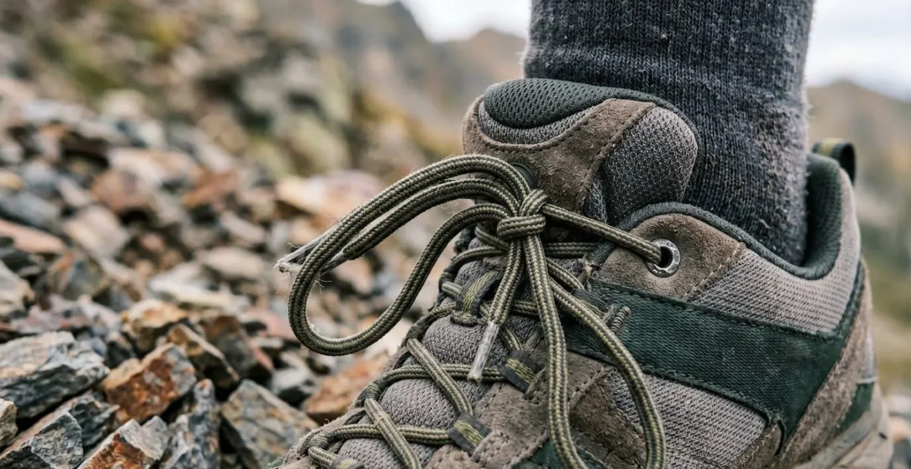
If you must use a lighter shoe, the focus must shift to maximizing what little support is available. This means employing advanced lacing techniques, like a surgeon’s knot over the instep and a heel lock, to create a more secure fit. This prevents your foot from sliding inside the shoe, which is the precursor to blisters and instability. However, this is a mitigation strategy, not a solution. The fundamental mismatch remains: using a tool designed for linear efficiency in an environment that demands multi-directional stability. For a solo hiker, where a simple twisted ankle can escalate into a full-blown emergency, the weight penalty of a more supportive boot is often the most prudent safety investment you can make.
When to Trigger Your SOS Beacon: Defining « Life or Death »?
Pressing the SOS button on your satellite messenger is one of the most consequential decisions you can make in the backcountry. It initiates a complex and resource-intensive response, often involving volunteer SAR teams and potentially aircraft. The scale is significant; globally, services like Overwatch x Rescue coordinate 10,000 rescues annually across hundreds of agencies. Abusing this system for non-critical situations erodes its integrity and diverts resources from genuine emergencies. The guiding principle for activation is simple: you are in a situation of grave and imminent danger with no possibility of self-rescue.
This is the « life or death » threshold. A trip-ending inconvenience is not a life-or-death emergency. A vehicle breakdown at the trailhead, a sprained ankle that is still weight-bearing, or running out of desirable food are not SOS-worthy events. These are situations where you should use the two-way messaging capability of your device to communicate your status and arrange for help. A true emergency involves a clear threat to life or limb: a broken leg, a person showing signs of severe hypothermia or altitude sickness, an encounter with a dangerous animal resulting in injury, or being completely lost and out of supplies as darkness falls in bad weather.
The difference between a Personal Locator Beacon (PLB) and a satellite messenger is crucial here. A PLB is a one-way street: you press the button, and the signal goes out with no further context. A two-way messenger (like a Garmin inReach or Zoleo) is far superior from a SAR perspective. It allows you to communicate the exact nature of the emergency. « Climber has fallen, suspected femur fracture » is infinitely more useful than a simple distress signal. This allows the response center to dispatch the correct resources (e.g., a team with technical rope rescue gear) and provide you with life-saving instructions while you wait. The SOS button is your last resort, reserved for when you have exhausted all other options for self-preservation.
How to Plan Exploring Adventure Destinations Without Voiding Your Travel Insurance?
Your satellite messenger is a physical lifeline; a specialized adventure insurance policy is your financial one. A common and potentially ruinous mistake is assuming a standard travel insurance policy will cover you in the backcountry. These policies are designed for resort vacations, not remote expeditions. They are riddled with exclusions for activities that are the very reason you are out there. Helicopter evacuation can cost tens of thousands of dollars, and a standard policy may cover only a fraction, if any, of that cost.
The key is to seek out specialized adventure insurance from providers like World Nomads or the American Alpine Club. These policies are built to cover the specific risks of outdoor pursuits. The differences in coverage are stark and absolute. A standard policy may exclude « mountaineering » above 4,000 meters, unguided trekking, or any activity involving ropes. A specialized policy will explicitly cover these activities up to a certain altitude (e.g., 6,000 meters) and will have much higher limits for Search and Rescue expenses, often including helicopter evacuation specifically.
Before any trip, you must act as a forensic accountant, dissecting the policy document for « poison pill » clauses. A detailed comparison of insurance policies clearly shows the gaps. Scrutinize the definitions and exclusions. What does the policy define as « mountaineering »? Is skiing « off-piste » covered? Is there a limit on medical evacuation that would only get you to the nearest rural clinic instead of repatriating you home? Your gear is only one half of your safety system; the policy that backs it up is the other.
Your Pre-Departure Safety System Audit
- Points of contact: List all communication channels where your distress signal can be received (satellite messenger, PLB, phone) and confirm their operational status.
- Collection: Inventory all existing safety gear (first aid, navigation, shelter) and verify they are complete, functional, and appropriate for the specific trip.
- Coherence: Compare your planned itinerary and activities against the explicit coverage and exclusion clauses of your insurance policy.
- Memorability/Emotion: Review your emergency plan. Is it simple, clear, and committed to memory? Have you shared it with a reliable contact?
- Integration Plan: Identify gaps in your gear or insurance coverage and create a prioritized plan to purchase, replace, or update before departure.
Are Biometric Wearable Devices Accurate Enough for Marathon Training Zones?
For the self-aware adventurer, biometric data from a wrist-based wearable seems like a powerful tool for managing effort and assessing physical condition. While these devices are excellent for tracking all-day activity and sleep, their accuracy for real-time, high-stakes training and health monitoring is compromised by their core technology: optical heart rate (OHR) sensors. For precise heart rate zone training or assessing heart rate variability (HRV), an EKG chest strap remains the gold standard.
The failure mechanic of OHR is rooted in physiology and environment. These sensors work by shining an LED light into your skin and measuring the light that scatters back from blood flow. Anything that impedes this process degrades accuracy. A case study comparing wrist-based OHR to a chest strap during high-intensity intervals reveals a significant data lag of 10-30 seconds. The reason is often vasoconstriction—in cold weather, your body reduces blood flow to the extremities to conserve core heat. Less blood flow at the wrist means a weaker signal for the OHR sensor to read. This lag can cause you to overshoot training zones, leading to burnout or inaccurate performance data.
Cold weather reducing blood flow to the wrist, sunscreen interfering with the sensor, and even dark tattoos can compromise optical HR accuracy.
– Outdoor Adventure Tech Analysis, Environmental Interference Factors in Wrist-Based Heart Rate Monitoring
For steady-state efforts like a long, slow hike in temperate conditions, a modern OHR sensor worn snugly on the outside of the wrist can be reasonably accurate. However, for any activity involving rapid changes in effort (intervals, steep climbs) or conducted in the cold, the data cannot be fully trusted for critical decisions. Treat your watch’s HR data as a general indicator, but for the precision required for serious training or health monitoring in the field, a chest strap is the only reliable tool.
Key Takeaways
- System Redundancy Over Features: Prioritize gear that provides true redundancy by not sharing the same failure points (e.g., dedicated GPS vs. phone).
- Understand the Physics: Know why your gear fails. Breathability depends on vapor pressure, battery life on temperature, and solar charging on direct sunlight.
- Your Device is an Evidence Locker: The GPS track log and message timestamps from your satellite messenger are irrefutable proof for SAR and insurance. Use them methodically.
How to Plan Exploring Adventure Destinations Without Voiding Your Travel Insurance?
We’ve established that a specialized insurance policy is essential. However, having the right policy is not enough. In the event of a claim, the burden of proof is on you. The insurer may argue that you were acting recklessly or outside the bounds of your declared itinerary. This is where your off-grid technology transforms from a safety device into an irrefutable evidence-gathering tool. Your satellite messenger’s track log is your black box recorder.
Before your trip, your planning must be meticulous. Document your intended route with GPS waypoints and share it with both your emergency contact and your insurer, if possible. Once on the trail, activate your device’s tracking feature from the moment you leave the car. This creates an unbroken, time-stamped digital record of your movements. This is not about being watched; it is about creating an objective, third-party-verified account of your actions that can dismantle any attempt to deny a claim based on speculation.
Imagine a scenario where you require evacuation from a location slightly off your planned route due to an unforeseen obstacle like a washed-out bridge. Without evidence, an insurer could argue you were on an unapproved detour. With your GPS track log, you can prove you were following the intended path until you encountered an impassable obstacle, and that your deviation was a necessary and prudent safety measure. This level of documentation removes subjectivity from the equation. It proves you were operating within the parameters of your plan and the coverage you paid for. You are building a legal and financial fortress around your adventure, using the very same tools that ensure your physical safety.
Your safety in the backcountry is your personal responsibility. Assess your gear with a critical eye, understand its limitations, and invest in a system that provides true, redundant security. Your life may depend on it.
Frequently Asked Questions on Outdoor Adventure Tech
What is the actual SOS signal transmission process?
When triggered, a 406 MHz signal is sent to satellites, which includes GPS data. The signal is routed through private GEOS or IERCC services for satellite messengers, who verify the emergency, contact your designated emergency contacts, and dispatch local SAR (Search and Rescue) teams.
What should I communicate in a non-critical emergency?
Use two-way messaging instead of SOS for trip-ending inconveniences. Example pre-set messages: ‘Car won’t start at trailhead. All safe. Need tow.’ or ‘Twisted ankle, can walk slowly. Exiting via alternate route. ETA +4 hours.’ This preserves SOS credibility for genuine life-threatening situations.
What information do SAR operators most need during activation?
Precise GPS coordinates (automatically transmitted), number of people in party, nature of emergency (injury/illness/environmental), immediate dangers present, and your planned route/destination. The immutable GPS track log from your messenger provides irrefutable timeline evidence.